January 2020:
Hello. We're still here, and we've every intention of getting this blog back up and running, but it's taking longer than expected. Keep an eye out for a big refresh before March. Thanks for stopping by.
Friday, 25 January 2019
Personal
On our way home
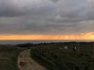
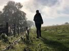
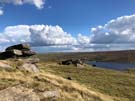
The border crossing at Gretna has a special place in my heart. It's where the Coastwalk will end; it's a place I've stopped many times before on my way up and down the country.
But today the significance is greater than usual.
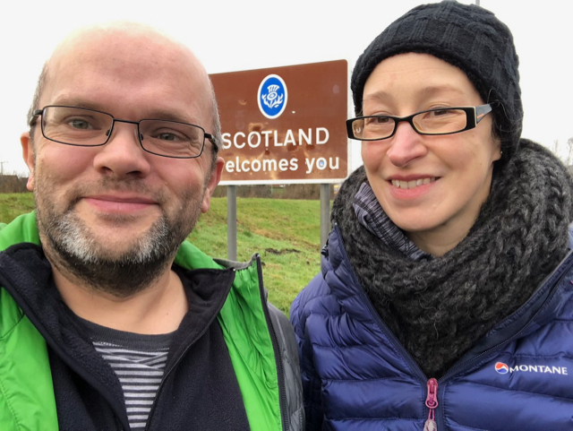
Today we cross the border heading north on our way home.
Monday, 14 January 2019
South Downs National Park and East Sussex
Ashdown Forest
 Distance: 7.47 miles
Ascent: 209 metres
Duration: 2 hours 13 minutes
17. Groombridge and the Medway Valley
 Distance: 5.82 miles
Ascent: 182 metres
Duration: 1 hour 46 minutes
13. Hartfield, Withyham and Five Hundred Acre Wood
 Distance: 3.74 miles
Ascent: 154 metres
Duration: 1 hour 11 minutes
3. Airman's Grave and Duddleswell
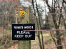
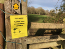
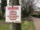
Pooh should be ashamed. A sign on the edge of Five Hundred Acre Wood insists that visitors are not welcome. Try telling that to the Chinese tourists I met at Poohsticks Bridge asking for directions to the House at Pooh Corner.
And now the answer to my question is now clear. Today's are going to be my last Sussex Walks for a while. I've managed to complete all the walks on the eastern page of the West Sussex book, and all those on the western page of the East Sussex book; twenty-eight in total, exactly half of the walks in the combined volumes.
Sunday, 13 January 2019
South Downs National Park and East Sussex
Sunday Afternoon Stroll
 Distance: 4.59 miles
Ascent: 29 metres
Duration: 1 hour 21 minutes
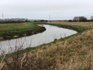
5. Barcombe Mills & the Ouse Valley
A final quick walk to round the afternoon out, taking in two sides of the Sussex Ouse. Almost everybody else I saw was walking their dog, and it's easy to see why: this is simple, enjoyable strolling.
West Sussex and the South Downs
Wild Life
 Distance: 6.59 miles
Ascent: 71 metres
Duration: 1 hour 58 minutes
16. Belloc's Mill
 Distance: 4.01 miles
Ascent: 106 metres
Duration: 1 hour 6 minutes
6. St Leonard's Forest
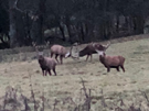
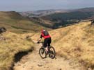
Setting off from the village of Shipley at dawn, I soon crossed a deer fence into the Knepp Castle Estate. Across the field I could make out shadowy figures pacing back, then tangling together with a clatter of antlers. It was a sight that almost caused me to return to the car immediately: nothing else could top it.
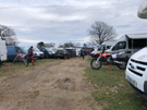
On the second walk a very different sound filled the woodland. The roar of engines and the smell of two-stoke from the motocross circuit were a world apart from the tranquility of the first walk. Wild life of a very different kind.
Saturday, 12 January 2019
South Downs National Park and East Sussex
White Cliffs
 Distance: 7.04 miles
Ascent: 321 metres
Duration: 2 hours 9 minutes
15. Beachy Head and Long Down
 Distance: 6.80 miles
Ascent: 376 metres
Duration: 2 hours 10 minutes
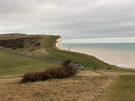
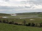
19. Friston Forest, the Seven Sisters & Cuckmere Haven
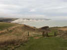 Distance: 4.17 miles
Ascent: 182 metres
Duration: 1 hour 14 minutes
7. Cuckmere Haven from Seaford
Once again I've prised Emma from her desk, this time with the promise of salty air. We now know the date we'll be leaving Sussex, so felt the need to see the sea one last time, and where better than by the Seven Sisters? The next time we're near saltwater it'll be when we're settled in our new home. Not long now.
Friday, 11 January 2019
West Sussex and the South Downs
Wealden Walking
 Distance: 8.90 miles
Ascent: 128 metres
Duration: 2 hours 28 minutes
23. Arlington and Abbot's Wood
 Distance: 9.46 miles
Ascent: 342 metres
Duration: 2 hours 45 minutes
20. Mayfield and Wadhurst Park
 Distance: 7.75 miles
Ascent: 234 metres
Duration: 2 hours 22 minutes
18. Blackboys and Waldron
For today's walks I'm off the downland and deep in The Weald instead. That means I've exchanged lofty close-cropped grassy expansed for muddy, intensively-farmed landscape.
Sunday, 6 January 2019
South Downs National Park and East Sussex
White Figures
 Distance: 9.66 miles
Ascent: 264 metres
Duration: 2 hours 45 minutes
25. Cuckmere River and Norton Top from Alfriston
 Distance: 4.86 miles
Ascent: 238 metres
Duration: 1 hour 26 minutes
9. Firle Beacon and Charleston Farmhouse
 Distance: 8.62 miles
Ascent: 368 metres
Duration: 2 hours 34 minutes
21. Alfriston, Long Man of Wilmington and Jevington
The Long Man of Wilmington must be one of the country's most famous white hill figures, said to be the tallest figure of a human in Western Europe. I passed it towards the end of this equally epic walk, and near the beginning passed a smaller chalk figure that I'd not known before: a white horse facing the village of Littlington. On the stretch of path joining the two I found my favourite figure though: a simple chalk drawing of downland on a fence post, annotated with the words "choose love".
Saturday, 5 January 2019
West Sussex and the South Downs
The Two Rings
 Distance: 11.42 miles
Ascent: 460 metres
Duration: 3 hours 41 minutes
27. Cissbury and Chanctonbury Rings
Emma's been working hard during the Christmas and New Year period, which is why I've done most of these walks on my own, but she wasn't able to resist the thought of linking the two hill forts at Cissbury and Chanctonbury. We've been to both before, but never connected them on foot.
Tuesday, 1 January 2019
South Downs National Park and East Sussex
Downland Memories
 Distance: 9.74 miles
Ascent: 370 metres
Duration: 2 hours 45 minutes
26. Download walk from Telscombe
 Distance: 12.58 miles
Ascent: 510 metres
Duration: 3 hours 51 minutes
28. Lewes, Balmer Down and the River Ouse
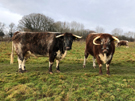
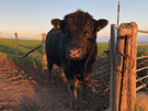
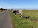
My worst ever experience with cows was on the stretch of the South Downs Way climbing from Cricketing Bottom to Mill Hill near Rodmell. Our write-up from that day doesn't mention the herd that refused to get out of the way, the bull that subsequently ran at us, and the frantic fence-hopping that ensued, but I remember it well. Walking in the opposite direction today I met a similarly recalcitrant beast and used the same technique to exit the field but at least this time I wasn't so panicked by the experience.
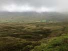
But don't let this put you off this stretch of the Downs. The lofty path above Standean in particular is a delight, with the sea on the horizon and miles of rippling countryside ahead.
Monday, 31 December 2018
West Sussex and the South Downs
In the Air
 Distance: 3.97 miles
Ascent: 210 metres
Duration: 1 hour 18 minutes
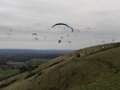
7. Devil's Dyke
I wasn't surprised to see paragliders throwing themselves into the air at Devil's Dyke, but the number of them on this cold winter day took my breath away, as did the stiff climb up from the village of Fulking. A lovely circular walk to end the day.
South Downs National Park and East Sussex
In the Opposite Direction
The next few walks will all feature part of the South Downs Way, which we walked back in 2010–2011.
![]() Distance: 10.06 miles
Distance: 10.06 miles
Ascent: 502 metres
Duration: 3 hours 1 minute
27. Ditching Beacon and Wolstonbury Hill
 Distance: 8.76 miles
Ascent: 295 metres
Duration: 2 hours 29 minutes
22. Blackcap and Stanmer Down from Ditching Beacon
I know Ditching Beacon very well; it used to be a favourite haunt when I lived with Mum and Dad. Nothing's changed in the direct vicinity, but the distant view is different now. Looking towards Brighton the i360 now dominates the town and in the Falmer direction the Brighton and Hove Albion's new stadium asserts itself rather too much amidst the download scenery.
Sunday, 30 December 2018
West Sussex and the South Downs
Beneath the Downs
 Distance: 10.76 miles
Ascent: 126 metres
Duration: 3 hours
26. Bramber, Beeding and the Downs Link
Broadly following the line of the River Adur, this morning's walk felt almost East Anglian in character with wide flood plains and a broad horizon.
Saturday, 29 December 2018
West Sussex and the South Downs
Before the Sun Sets
 Distance: 5.79 miles
Ascent: 225 metres
Duration: 1 hour 54 minutes
13. Wolstonbury from Hurspierpoint
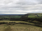
Wolstonbury Hill is just east of where the A23 crosses the South Downs. It's a hill I've seen many times from the road but never climbed. The view from the top across the Weald towards the North downs is tremendous, but I didn't have time to linger today if I was to be down before sunset.
South Downs National Park and East Sussex
West to East
 Distance: 9.61 miles
Ascent: 222 metres
Duration: 3 hours 1 minute
24. Sussex Border Paths from Fletching
The Greenwich Meridian bisects Sussex, so on this walk close to the East/West Sussex border I crossed it a few times, and weaved around the Greenwich Meridian Trail, a relatively new long distance path which I'd love to walk one day.
Friday, 28 December 2018
West Sussex and the South Downs
Among the Bluebells
 Distance: 7.79 miles
Ascent: 290 metres
Duration: 2 hours 24 minutes
23. West Hoathly and Weir Wood Reservoir
 Distance: 4.99 miles
Ascent: 168 metres
Duration: 1 hour 35 minutes
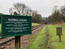
9. Horsted Keynes and the Bluebell Railway
 Distance: 4.92 miles
Ascent: 163 metres
Duration: 1 hour 35 minutes
10. Ardingly Reservoir
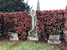
The Bluebell Railway is the theme that links these three walks. The heritage railway runs steam trains on a line stretching from East Grinstead near the first walk through Horstead Keynes on the second. That's where you'll also find the grave of Harold Macmillan. While I heard the trains today, I didn't actually see them. Perhaps it's not the best time of year for bluebells.
Thursday, 27 December 2018
West Sussex and the South Downs
Close to home
While we're staying in Sussex a while I've picked up the two local books of walks in the Pathfinder Guides series. Each has twenty-eight walks. My challenge is to complete as many as possible before we move on. The write-ups will be brief.
 Distance: 5.35 miles
Ascent: 193 metres
Duration: 1 hour 39 minutes
12. Cuckfield and Ansty
Let's start with the walk that's only a mile away from home. I know some of these paths, and I really dislike them. Mud: that's the defining characteristic, at any time of year. Not the best introduction to Sussex.
Friday, 14 December 2018
South Downs Way
Alfriston → Eastbourne (Bridleway)
 Distance: 7.97 miles
Ascent: 396 metres
Duration: 2 hours
An epilogue
« Not walked | Not walked »
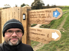
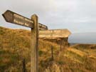
Between the village of Alfriston and its eastern terminus in Eastbourne the South Downs Way has two alternative routes. The most popular — and the one we walked in 2010 is a footpath over Beachy Head and the Severn Sisters. Since horse riders and cyclists aren't permitted on that route, an alternative bridleway follows the northern edge of the Downs escarpment; that's the route I've followed today.
So as a birthday treat to myself I'm back on a National Trail.
There are essentially just two climbs on this route, with the village of Jevington at the halfway point providing a break between them. (Fun fact: Jevington is the birthplace of Banoffi Pie.)
I started the first ascent — Windover Hill — just before dawn, and had the downland to myself save for a solitary horse rider. By the time I reached Eastbourne, the dog walkers were out in force, and the sun had begun to warm the mist.
 I had considered returning on the footpath across the chalk cliffs. But although it's been a good morning to be out, it's too cold to turn this into a circular walk. I took the bus back to the village.
Wednesday, 28 November 2018
Personal
Step two
So that finally happened.
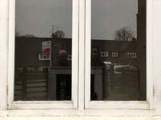
We locked our front door in Maidenhead and left the key with the estate agent. It's been eleven months since we put our house on the market, and three months since we agreed a sale.
There'll be things we'll miss. Mostly I'll miss my daily walks to Windsor and back, always checking in on a few of the neighbourhood cats I've given new names to over the years. But really we're ready for what's next.
Step two starts in earnest now: find somewhere else to live.
Tuesday, 13 November 2018
Gig
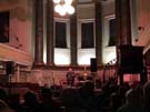
Over the Rhine, Union Chapel
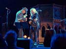
Ever since I first saw them in about 1993 I have taken every opportunity I can to see Over the Rhine play live. And at the Union Chapel? Who could say "no"?
These songs have provided the soundtrack to my life for a very long time, and judging by the sneak preview of new songs tonight, I imagine I'll be carrying them around a while longer yet.
Saturday, 10 November 2018
Gig
Bruce Cockburn, St Pancras Church
Right now I'll take any opportunity I can to see Bruce Cockburn play. His long career means he suffers from an obsessive fan-base who all want to hear their own personal favourites. I'll never call mine out, but I was delighted to hear one of them today, Bone in my Ear from his massively underrated 1993 album Dart to the Heart.
Cockburn's probably best known as a political singer, but that I hold that collection of songs of love more dearly than any of his other work.
Tuesday, 23 October 2018
Gig
U2: eXPERIENCE + iNNOCENCE
Three years later we're back at the O2 for the "return leg" of U2's phenomenal tour, and the message seems more urgent than ever before.


Can't we still be friends?
Friday, 28 September 2018
Hadrian's Wall Path
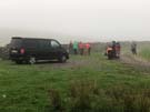
Carlisle → Bowness-on-Solway
 Distance: 15.54 miles
Ascent: 170 metres
Duration: 5 hours 30 minutes
The salt marsh
« Gretna | Not walked »
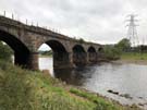
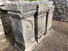
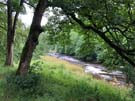
 Hadrian's Wall Path follows the coastline for most of its length west of Carlisle, so I've walked much of today's leg before. After following the River Eden through Grinsdale, Kirkandrews-on-Eden and Beaumont, the path finds itself at Burgh by Sands where the church contains fragments of decorative Roman masonry built into its interior, and a plaque commemorates the first recorded African community in Britain, a cohort of Ethiopian soldiers who guarded a local fort.
 We were soon on the course of the Wall again, walking the long, straight road over the tidal Burgh Marsh. An 8.9 metre tide was scheduled for the afternoon, almost guaranteed to flood the road, so although it was tempting to linger and admire the expansive view we hurried on to the safety of Drumburgh at the western end of the causeway.
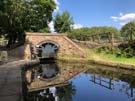
Stopping briefly at the Post Carlisle photo opportunity, we followed the end of the Wall Path along the narrow road to Bowness on Solway. The views here were spectacular: the Scottish lowlands to the north and shimmering reflections of clouds above the Solway Firth.
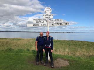
The official end of the Path comes as a slight surprise: a small wooden shelter stands over a mosaic floor, decorated with pictures of the many wading birds that accompany the finals stage of the route along the Firth. Although this walk has been all about military engineering, it's as much about how humans have adapted to, and worked with, the huge natural landscape.
Thursday, 27 September 2018
Hadrian's Wall Path
Walton → Carlisle
 Distance: 11.54 miles
Ascent: 125 metres
Duration: 3 hours 54 minutes
Completing the circuit
« Not walked | Beaumont »
We think we're beyond the last of the in-situ masonry of Hadrian's Wall now. All that's left is the impression of the Vallum crossing the increasingly agricultural landscape.
 Approaching Carlisle the Path turns away from the invisible route of the wall, favouring a riverside meander along the River Eden instead.
 Just east of the city we paused briefly where we crossed the M6 motorway to recognise that the next time we pass under that bridge we'll be driving north to a new home in Scotland. It's a moment that can't come soon enough.
 Another significant point came at the end of today's walk. We actually walked on beyond the formal end point of the leg to the disused railway bridge over the River Eden. Sneaking between the iron railings protecting walkers from the old structure, it was there that I crossed the river on my coastwalk in 2004. So with this little extra added, we completed our longest continuous walking circuit yet: around most of the coastline of England and Wales, then back to Carlisle along this week's ancient route.
Wednesday, 26 September 2018
Hadrian's Wall Path
Steel Rigg → Walton
 Distance: 17.24 miles
Ascent: 765 metres
Duration: 6 hours 39 minutes
Into the wind
« Not walked | Not walked »
The wind was our greatest foe today. From the moment we woke up at The Sill YHA we knew what was against us: looking out of the window, all the trees were standing defiantly but their branches stretched out wildly, giving the game away,
 Heads down with hoods tightened, we headed west. Again we were on familiar territory across the backs of crags that we'd climbed in March. A young cat bounded up the path to greet us at Thirlwell Castle, and shortly after we parted company with the Pennine Way to continue on as-yet-unknown territory.
 Detours were the order of the day once we'd crossed into Cumbria, with a collapsed footbridge, another under reconstruction and a re-routing of the path all nudging us away from our originally intended route. The National Trails website is an excellent resource for learning about such things, so none of them took us by surprise.
 At Birdoswold Fort we saw some rude tourists who seemed singularly unimpressed with the wall itself. Perhaps their expectations had been set unfairly high; having walked alongside it for four days (so far) meant that all we could do was shake our heads in disagreement.
Tuesday, 25 September 2018
Hadrian's Wall Path
Chollerford → Steel Rigg
 Distance: 12.84 miles
Ascent: 771 metres
Duration: 4 hours 36 minutes
The craggy days
« Not walked | Not walked »
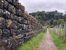
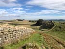
That's more like it! We always knew today's walk (and most likely tomorrow's) would be a highlight of the week, but that it would also be difficult. Welcome to the middle third of Hadrian's Wall Path, otherwise known as "the craggy days".
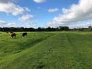
 The first part of the day was similar to yesterday, marching alongside the Military Road. There were more wall fragments to look at including a particularly fine temple to Mithras at Brocolitia Fort. Once we reached Sewingshields the character changed completely as Hadrian's soldiers hammered on across the rocky crags but General Wade — intimidated by the Whin Sill — took his road slightly further south. Even the Romans gave up eventually though: at Limestone Corner the quality of workmanship takes a sudden decline as the soldiers passed the construction baton to geological forces. This section is frequented more by cattle than humans, and it's fascinating to see them milling around the Roman remains.
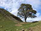
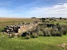 Before long we were at Houseteads Fort, and completed the day by re-walking a stretch that we'd traversed earlier in the year on the Pennine Way as far as Steel Rigg. It's a fine section to repeat, with highlights including the only section of wall which has a public footpath running along its top, Castle Nick and Sycamore Gap. The switchback of the path was well worth the effort as it clung to the rippling landscape.
 Our fast pace today meant that we reached the end of this leg with sufficient time in the bag to spend most of the afternoon exploring the extensive remains at Vindolanda, a Roman settlement that pre-dates the wall just a few miles to its south.
Monday, 24 September 2018
Hadrian's Wall Path
Heddon-on-the-Wall → Chollerford
 Distance: 15.63 miles
Ascent: 403 metres
Duration: 5 hours 28 minutes
A tedious trudge
« Not walked | Not walked »
Unlike yesterday, we've never been far from Hadrian's Wall but there's not been much, if any of it, to see. Blame General Wade. When constructing a military road between Carlisle and Newcastle he followed the route of the Roman Wall precisely, either robbing it for materials or building directly on top of it.
Over the centuries Wade's road has been upgraded and now forms the modern B6318. So to make matters worse, we've pretty much been on the course of a trunk road all day.
 There was curious wall-building of a modern kind to be seen though. At East Wallhouses, two defunct games consoles have been used in place of stones in a garden wall. I don't think this wall will be round long enough for archaeologists to be baffled by it though.
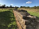
 Once again the highlights came towards the end. Just outside the village of Wall the road and wall diverge, leaving a fantastic stretch of Roman ruin running through the field.
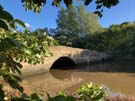
 A little later the wall crosses the North Tyne River, and a brief detour from Chollerford Bridge gives access to the ruins of the old Roman bridges. This must have been a spectacular piece of engineering; all that's left now is a group of stones arranged in the grass by the bank.
Tomorrow promises to start with much of the same, before finally hitting the spectacular crags.
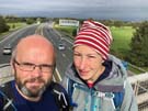
Sunday, 23 September 2018
Hadrian's Wall Path
Wallsend → Heddon-on-the-Wall
 Distance: 16.50 miles
Ascent: 255 metres
Duration: 5 hours 18 minutes
Walls end
« Not walked | Not walked »
As hinted at ten days ago, it's time to start walking the last National Trail: the Wall. Today though, there's not been much Wall to see.
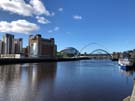 Hadrian's Wall extended from Wallsend on the Tyne to Bowness-on-Solway in Cumbria, but since its construction in the second century different parts have endured different fates. Here at the eastern end there's little evidence left on the ground. While the outline of a Roman fort can be made out at Wallsend, there's nothing to be seen of the Wall that passed through what is now modern Newcastle. The Path then takes to the riverbank, following the Tyne through the town (and under its famous bridges; we stopped to enjoy roast pork stotties from a stall in the busy market).
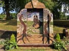
 On the edge of the town a touching monument commemorates the Montagu View pit disaster of 1925. Thirty eight men and boys were killed by a surge of flood water and methane, caused by a routine blast penetrating into the abandoned workings of the adjacent Paradise Pit. The men who laid the blasting charges were covering for others who had overslept on the day; the pit plans - which would have shown the surrounding workings - weren't available. This avoidable accident took the lives of 22 people from the small village of Scotswood, a devastating loss.
 Hadrian's Wall Path crosses the A1 and finally heads north and uphill to the village of Heddon-on-the-Wall where at last the remains of the actual wall are visible (though not directly on the route of the Path). The wall's an impressive structure. We've seen it before on our Pennine Way traverse, but found it hard to imagine the extent of the structure. Walking its entire length this week, even though evidence of the physical wall will be missing in many places, will enable us to appreciate first hand the sheer enormity of this coast-to-coast construction.
Notes for future walkers:
- At Segedunum, take a moment to walk to the north west corner of the fort where a reconstruction of the wall shows its estimated height.
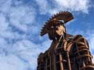
- The actual starting point of the National Trail isn't entirely clear, but seems to be the sculpture of a Roman soldier in the Segedunum car park.
- The Path has been rerouted away from the river bank at NZ 151 652, running north until it joins the Waggonway running west.
- The existing stretch of wall in Heddon-on-the-Wall is on the south side of the B6528 just east of the village.
Saturday, 22 September 2018
Coastwalk
Howdon → North Shields
 Distance: 3.77 miles
Ascent: 73 metres
Duration: 1 hour 2 minutes
Shields Harbour
« Not walked | Whitley Bay »
Our hopes to walk under the Tyne from Jarrow have been scuppered. The pedestrian and cyclist tunnels under the Tyne only opened in 1951, but have been closed for the past five years for extended refurbishment. So we've opened a "gap" in our coastwalk as we took a shuttle bus across the river.
The land on the north bank of the river has been redeveloped faster than the south. Instead of negotiating disused quays and wharfs, there's a maze of marinas and apartment blocks, not quite linked by dead-end roads and a conspicuous lack of thought for through-walkers. The route we took was on slightly higher ground though, giving us a better view of the activity on the river below.
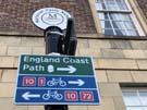 We were soon at the ferry terminal at North Shields, where we were delighted to see that since last coming here in 2013 an "England Coast Path" sign has been erected to welcome circumnavigators crossing the river by boat.
Tomorrow we'll turn our back to the coast and head west across the neck of the country.
Coastwalk
South Shields → Jarrow
 Distance: 4.03 miles
Ascent: 64 metres
Duration: 1 hour 11 minutes
A coastal prelude
« Seaham | Not walked »
The observant will have noticed we've not added to the coastwalk this year. Time to rectify that.
Our goal for the coming week is to walk Hadrian's Wall Path, the only one of England and Wales' National Trails that I've not yet completed. The path connects with the coast at the western end, but not at the east. Before we start on the week's walking then, we're heading up-river from the Shields Ferry to the Tyne Tunnels (just a mile and a half from Hadrian's Wall Path's eastern terminus) and back.
 The southern bank of the river is out of reach for this stretch, barred by docks and car terminals. There's a moment of relief at Jarrow where a footpath follows the bank of a stream past Jarrow Bridge and the remains of Jarrow Monastery, but even that is short-lived and dominated by electricity pylons. A glimpse of the river follows before it's hidden again behind high steel fences surrounding yet another wharf that's being slowly reclaimed by nature.
Wednesday, 19 September 2018
Album , Gig , Theatre
Northern Flyway
We came across Northern Flyway by chance in January. With a gap in our schedule for the weekend we were at Celtic Connections in Glasgow, we picked the show from the programme that sounded most interesting (and besides, Sarah Hayes was playing in it; we'd seen her with Admiral Fallow).
Taking our seats in the Tron Theatre back then, we didn't know what to expect. Tonight was different: we'd seen the show and knew the music so had to return to for the London date of the tour.
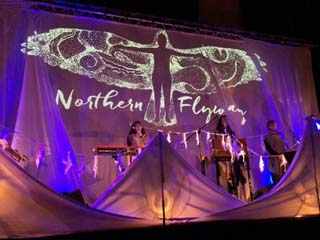
Just about every way of classifying Northern Flyway won't do it justice. Is it folk music? Beatboxing? Theatre? Nature documentary? Birdsong catalogue? And dare you mention the gorgeous custom knitware?
Imagine all these elements brought to life with beautiful harmonies and a heartful of joy and you'll begin to approach the experience.
Two curlews duet about their lifelong bond, singing of dancing above heather moorland; waxwings flock and wheel around the sky in a twittering bundle, and owls find safety and shelter in the statue of Athena, their ancient protector and the source of the enduring myth of their wisdom. Folklore, ornithology and sociology mesh together. Stories of the struggles of migration apply equally to bird and human endeavours.
Perhaps we're sounding too enthusiastic. But here's the thing: Northern Flyway is a unique production that we're delighted to have caught. We'd recommend everyone go along.
And if you can't get to a show, the album was released last week providing the sonic experience if not the video and knitware.
(For bonus marks, pick up Jenny Sturgeon's The Wren and the Salt Air E.P., which perhaps marks the genesis of the Northern Flyway project. We came away tonight with two of Inge Thomson's CDs so we have homework of our own.)
Monday, 10 September 2018
Pennine Bridleway
Settle Loop
 Distance: 11.17 miles
Ascent: 555 metres
Duration: 3 hours 30 minutes
Joining up
Although I've completed the current linear Pennine Bridleway, there are still some optional extras left. The Trail includes two loops off the main route, and at about ten miles the Settle Loop is the shorter, providing a good morning walk.
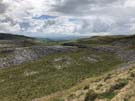
 For twenty years or so I had difficulty locating Malham on a map. It's up a bit of a dead end, and by road it's not particularly near anything. The Settle Loop challenges that perception, extending four miles east of Settle to provide a clear view of Malham Tarn (if not the Cove itself).
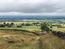
 I've really enjoyed "joining up" my knowledge of our island's geography on my walks, and there is no finer example than this. Looking east I remembered my first ever trip to Malham and Gordale Scar, as well as last year's passage through the village on the Pennine Way. On the return leg to Settle the Yorkshire Three Peaks presented themselves proudly on the horizon, reminding me again of last September, but also of this year's walks along the Bridleway. It's deeply satisfying to be able to scan such a wide horizon and see familiar features in almost all directions.
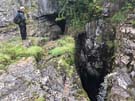
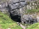 I detoured from the line of the Loop briefly to explore the Victoria Cave, a deep cleft in the limestone.
Its location just couple of miles outside of Settle was evident in that I met about a dozen people walking on these last few miles, but hadn't seen a single soul previously. I prefer the solitude of having the path to myself, but it's always comforting to see friendly faces.
Sunday, 9 September 2018
Gig
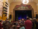
Niteworks
Back in Settle Victoria Hall, this time for a band I've seen before.
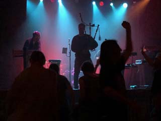
What you need to know about Niteworks' performance tonight:
- They had everyone dancing: from teenagers right up to eighty-somethings.
- The music scarcely stopped, band members switching instruments seamlessly without waiting for applause at the end of a song.
- By the end, everyone was exhausted, and everyone was grinning.
Even if the thought of Gaelic electronic dance music with bagpipes and poems doesn't sound appealing, go and see Niteworks anyway; you will be converted.
Pennine Bridleway
Garsdale Head → Street
 Distance: 10.37 miles
Ascent: unknown
Duration:
A disappointing end
« Not walked | Not walked »
It's always a joy to stay overnight directly on the path. The convenience is one thing, but also you often meet like-minded walkers in the bar or over breakfast. And so it was at the Moorcock Inn, where we chatted with a couple from Ayr. They were in the area with their local walking group, the majority of whom we'd met the previous night in Hawes YHA, but our friends had made the sensible decision to eschew dormitories, bunk beds and self catering for this comfortable B&B.
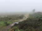
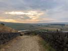
 Although the weather forecast for today was significantly better than yesterday's, we set out from the pub into a persistent drizzle. A relatively short climb took us to Lady Ann's Highway, a track which although level became higher and higher above the valley floor as the nascent River Eden dropped away.
 Heads down into the wind we didn't see the allegedly beautiful Hell Gill, but did stop for a breath at the Water Cut sculpture. Beyond here the path dropped to the valley road but before then the view was delightful, with rich farmland ahead, flanked on either side by the high, rocky moorland of Mallerstang Common.
The rain held off during our descent but returned as we ascended the flank of Wild Boar Fell to the pass at High Dolphinsty. Hopes of a clear view ahead were dashed by yet more low cloud, but at least the precipitation wasn't too heavy.
 Rather soon we reached tarmac, and before long the A683 where the Pennine Bridleway presently comes to a rather abrupt and underwhelming end. Plans to extend the trail for another hundred miles or so through Northumbria to Byrness have been approved but no funding has been secured to construct the path.
All in all the Pennine Bridleway isn't the best National Trail. It has its moments; it runs through some spectacular scenery, but by design it doesn't follow a natural theme. Instead its purpose is to get people to places. For walkers it's a good route for passing swiftly from the Peak District to the North Pennines. Perhaps it'll find purpose as an element of LE-JoG routes that don't want the drama of the Pennine Way.
For me it'll always be the National Trail I was least fussed about finishing, but when I realised I was so close to completing all the others it would have been churlish to omit this one.
Walking from the end of the trail to the railway station at Kirkby Stephen we could make out the radar station on Great Dun Fell and to its north, the bulk of Cross Fell. I remembered the Pennine Way's onward route, and how just a couple of days' walking from where we stood would take us to Hadrian's Wall.
National Trail 14 is complete. Just one left, and it's along that Wall.
Saturday, 8 September 2018
Pennine Bridleway
Birkwith → Garsdale Head
 Distance: 16.10 miles
Ascent: 645 metres
Duration: 5 hours 6 minutes
The Three Peaks
« Not walked | Not walked »
The summer is officially over, but the hardy are trying to eke out as much as they can of its remaining moments. That's why I'm up in Yorkshire once more, keen to spend the next two days finishing off the Pennine Bridleway. For the first time on this National Trail I'm not alone. Jez has joined me for the weekend and the last twenty-five miles.
 Finding somewhere to park in Horton-in-Ribblesdale this morning was far from simple, and that fact was not entirely unrelated to the twenty or so people we came across just forty-five minutes into our walk. Horton is the natural place to start the Yorkshire Three Peaks Challenge, and the dozens of energetic twentysomethings we saw at High Birkwith had parked up and set out for Pen-y-Ghent probably before we'd even had breakfast.
It wasn't a good day to climb those hills. None of the three were really visible through the low cloud, and we were glad to be generally contouring round the edges of the valleys rather than aiming for the tops.
 For a while we joined the Pennine Way, but soon the Way and Bridleway diverged at their most northerly meeting point on the Roman Cam High Road.
It's such a shame the weather was so poor. There ought to be so much more to report about this walk, such as the magnificent Settle to Carlisle railway line snaking its way along the valley, diving into tunnels and thrusting out across viaducts between tortuously steep gradients. We did see the line through a couple of gaps in the cloud, but a strike today meant that no trains were running; the line was silent.
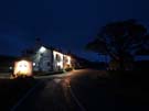
 Tonight we're staying at an isolated inn on a high pass between three dales. We arrived tired and soaking wet, but it's the sort of place where guests are expected to be disheveled. Of course within half an hour of our arrival the rain stopped and the sky began to clear. Perhaps that bodes well for tomorrow.
Friday, 7 September 2018
Yorkshire Dales
Cove and Scar
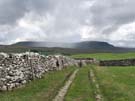
 Distance: 7.72 miles
Ascent: 248 metres
Duration: 2 hours 44 minutes
17. Around Malham
Here's a walk I've done twice before. It's a bit of a classic: a Malham circuit taking in the waterfalls of Janet's Foss and Gordale Scar before reaching Malham Cove via Malham Tarn.
It's a walk of high drama, and the centrepiece is climbing beside the waterfall at Gordale Scar. The climb is a fairly straightforward short scramble, made more intimidating by the thundering water alongside and the prospect of a dozen or so less adventurous spectators wondering what the heck you're doing. Stay to the left of the main cascade, and it'll be over before you know it. I genuinely believe pretty much anyone can do this.
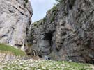
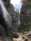
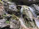
It's been twenty-five years since I first completed the circuit, and last time I tried water levels were too high to safely complete the ascent. But today conditions were perfect. An ideal warm-up for a couple of days in the Dales.
Friday, 31 August 2018
Greenbelt
Greenbelt 2018: Acts of the Imagination
Thirty years ago I was one of five teenagers turning up to our first Greenbelt Festival. Sixteen years old, and deeply impressionable, my life changed that weekend. I'm delighted it did.
I've been back to the festival every year since, and after ten years started to help organise it. 2018 is the first time I've not had any volunteer role in twenty years; this year I was a regular punter.
As ever I saw a lot of different things at the festival, but this year one act stood out perhaps more than any other has over the years: Pussy Riot. The Riot Days gig was the best thing I've ever seen at Greenbelt. It was a theatrical version of Masha Alyokhina's book, presented in the form of a punk gig. The gig told of Masha's part in Pussy Riot's infamous Punk Prayer, and her incarceration and challenges to Russia's harsh criminal justice system. It was loud, chaotic, shouty (in Russian with English subtitles), rude and a shock to just about every sense.
It was also liberating and challenging.
For example, is Putin's courting of the Orthodox Church any different to Trump's alignment with Evangelicals? Or for that matter, is it appropriate for me to say that I believe that the Christian faith is incompatible with voting for the party of individual personal wealth?

Two phrases really stuck with me: "Freedom doesn't exist unless you fight for it every day" was the penultimate line of the gig. But on the previous day when asked in an interview what the Greenbelt audience could learn from Pussy Riot, Masha simply said: "You are the motherland of punk". We don't need to learn. We need to act.
Two hours after the gig there was still a long queue for signed copies of Masha's book. Most seemed to be young, impressionable teenagers. I've never been more proud to have played a small part in Greenbelt's story. Long may it continue to upset, disrupt and inspire.
Monday, 13 August 2018
Pennine Bridleway
Settle → Birkwith
 Distance: 17.42 miles
Ascent: 725 metres
Duration: 5 hours 12 minutes
Ribble
« Not walked | Not walked »
This morning — just like four weeks ago — I found myself facing the end of a long weekend with a good distance ahed of me let to walk, and the prospect of rain coming in. At least this time I had the sense to have breakfast at my hotel before heading off, but that meant maintaining a pretty stiff pace all day.
Flowerpot Bo Peep shepherded me out of Settle, and after traversing the hillside I was soon crossing the River Ribble on the floor of the valley. A roundabout route on the other side took me along old green drove lanes from village to village, before finally ascending the flanks of Ingleborough.
The Pennine Way doesn't climb the hill itself, but the landscape it crosses is equally splendid, with vast limestone pavements reminding me that Malham Cove isn't the only place to see this remarkable rock formation.
In the end I made it to Horton-in-Ribblesdale with plenty of time to spare, and the rain didn't start in earnest until I was safely tucked inside the Crown Inn with a late lunchtime drink. One by one Pennine Way walkers (and one end-to-ender) wearily made their way into the pub, soaked to the skin having hauled themselves over a cloud-shrouded Pen-y-Ghent. Hopefully the camaraderie in the bar made up for the lack of a view from the top.
Once again I've had a great weekend; it would've been perfect had I not left my iPad in the station waiting room on my way home.
Sunday, 12 August 2018
Gig
Le Vent du Nord
It's so easy to fall into the trap of thinking that the best gigs take place in the cities. Settle's Victoria Hall convincingly disproved that theory tonight.
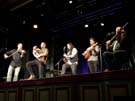 It was midweek when I noticed that the quintessential Québécois quintet that Emma and I saw three years ago in Glasgow were playing in this Yorkshire town tonight.
The gig was tremendous: fiddles, hurdy-gurdy, mandolin, keyboards, accordion, tap and all. I suspect Le Vent du Nord aren't capable of pulling off anything less than a thrilling, joyful performance.
 The real star for me though was the Victoria Hall itself. Claiming to be the oldest music hall in the world (though I'm aware of at least two others that lay claim to that crown), it's run by volunteers, has a lovingly curated artistic programme and equally diverse selection of drinks at the bar. The hall felt like the centre of a community of which I was proud to be a temporary member. I'll be back.
Pennine Bridleway
Barnoldswick → Settle
 Distance: 18.87 miles
Ascent: 592 metres
Duration: 5 hours 45 minutes
The parallel path
« Not walked | Not walked »
 Once again the weather has been kind to me. Sure, I didn't get the wall-to-wall sunshine of yesterday, but more importantly on a day that had a forecast of non-stop rain, I remained unexpectedly dry. After the prolonged heatwave, it appears as though normal service has been resumed when it comes to the weather.
 It's proving increasingly difficult for me to describe the Pennine Bridleway without reference to the Pennine Way. When I realised that today's leg started and finished with hills, but was otherwise across farmland, I remembered the route from Ickornshaw to Malham across the Aire Gap. Today I've crossed the same geological gap, about five miles to the west.
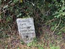
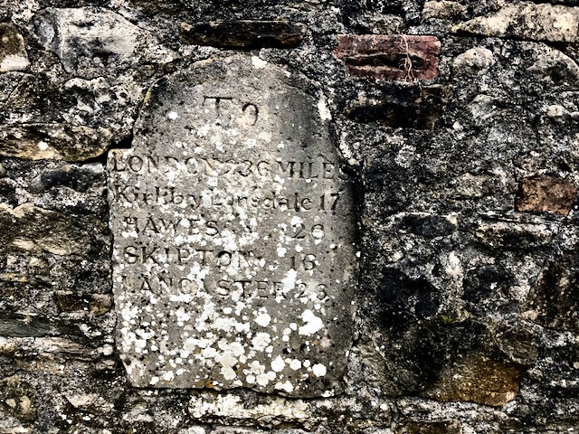 The best of the walk was the end: the long climb after Long Preston, and the drop into Settle. Between these two the character of the landscape changed to moorland, and with dark clouds brooding in the east it felt dramatic and exciting, something that's generally been missing elsewhere on the bridleway. The fact that the Settle milestone is to be found at the top end of town on this track perhaps indicates its importance as the old traditional route across the moors.
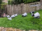
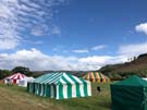
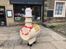 Settle itself is a lovely town, full of nooks and crannies, and well worth an explore. It's right in the middle of its annual Flowerpot Festival, with constructions made from flowerpots decorating every building and corner of the town. I've been through Settle on the train so many times but never stopped.
The town is also home to the Victoria Hall, said to be the oldest music hall in the world. Fortuitously there's a show on tonight that interests me, so here's another first on a walk: a post-exercise gig. Should be good.
Notes for future walkers:
- The signpost was missing at the foot of Brook Lane west of Halton West, but the turning is easy to find if you're got an eye on the map — it's immediately before Town Farm.
- There isn't a signposted route in Long Preston. I stayed on the B6478 until just after it crossed the railway before picking up a path behind the houses on the left. After crossing the A65 at the village green, the route out of the village is Green Gate Lane, tucked away on the left.
- The route in Settle is similarly vague. The best option is probably to head downhill until you hit the main square although I think the formal route stays on the highest road, just skimming the easternmost edge of the town.
Saturday, 11 August 2018
Pennine Bridleway
Worsthorne → Barnoldswick
 Distance: 16.48 miles
Ascent: 781 metres
Duration: 5 hours 26 minutes
Sunshine
« Not walked | Not walked »
My wish was granted. Today's walk was the best I've had so far on the Pennine Bridleway, and will be something I'll remember for a long time. Gone were the stony tracks that were such a feature of earlier legs, replaced with finer cinder paths, and even some meadows.
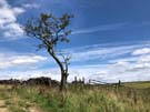
 Over to the east — looking resplendent in the sunshine — I saw Ickornshaw Moor, the first real challenge for us on our Pennine Way attempt last year. To the north the unmistakable shape of Pen-y-Ghent was visible on the far horizon, another foe from September.
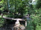 But there wasn't the slightest hint of hardship in today's walking, accompanied as I was by glorious sunshine. The highlight was the little village of Wycoller, with its delightful ancient bridges and fords, its ruined Hall and it tremendous tearoom.
 Do you get the feeling I enjoyed today? On the whole I've not been inspired by the Pennine Bridleway, but I'd gladly come back and repeat today's leg.
Friday, 10 August 2018
Pennine Bridleway
Mankinholes → Worsthorne
 Distance: 14.10 miles
Ascent: 737 metres
Duration: 4 hours 26 minutes
Intertwined
« Not walked | Not walked »
They were huddled together, talking animatedly as they looked at a phone. "Pennine Way?" I asked. They nodded. "You'll want to go this way," I said, encouraging them to continue down the track they were on. "Then why does does the sign show that way?" Asked the young European woman, pointing to a National Trail waymarker showing the path I'd taken out of the dell in Callis Wood. Her male companions (who admittedly had initially said they didn't want help) looked as me as if they'd just played a trump card. I pulled out my guide book. "Pennine Bridleway. Different thing."
 "Is there anywhere ahead we can buy a map?"
I showed them where I thought the famous Aladdin's Cave of May's Shop was and we talked a little more before heading our separate ways. To be honest, I was quite jealous at the thought of doing this long trek on the threshold of adulthood.
The Pennine Way and the Pennine Bridleway are intertwined on this section, at first crossing each other, then running together in three separate places. Using the same acorn waymark and having almost identical names, there are plenty of opportunities for confusion (especially when you factor in the odd missing or misplaced signpost).
 This intertwining was a delight and a challenge for me. I enjoyed the easier route of the Bridleway out of the Calder Valley, but then felt frustrated at how circuitous a route it seemed to take to reach Lower Gorple Reservoir. This was compounded by the sudden downpour that started as I reached Badger Lane. The rain skipped straight over the gentle shower phase and hit with a thunderclap which announced the arrival of plump raindrops, soon to be followed by hail, dumped from the sky.
 The showers eventually cleared, and my spirit lifted as I saw the reservoir wall ahead of me and recognised not déjà vu, but a clear memory of walking this way before, back in September last year.
Were it not for the Europeans, the rain and the reservoirs, today's walk would have felt a lot less interesting. Ultimately it was mile after mile of stoney track. This seems to be the defining characteristic of the Pennine Bridleway: a good surface for horse and bicycle riders to enjoy, but for walkers it's a long plod whose main goal is to cover distance. I hope tomorrow is better.
Saturday, 28 July 2018
Gŵyl Coda
Gŵyl Coda 2018: Gathering Hope
 The Welsh word "bach" translates literally as "small". But it also carries connotations of affection and love. You don't have to be small to have a big impact. Take Wales itself: a small country on our shared island, but with a deep influence.
 The first Gŵyl Coda festival was held in July this year. Is Coda "Greenbelt Bach"? Perhaps. The family semblance is there: a field with marquees, portaloos and traders; music, theatre, visual art, worship and workshops; a desire to engage with the world's injustices and celebrate its diversities. After listening to Wisam Salsaa talking about Banksy's "Walled Off Hotel", you could grab a falafel from a Machynlleth social enterprise, look at paintings inspired by floor tiles at the nearby Strata Florida Abbey, while in the next tent Nikko Fir sang touching songs of hope in the main Hwb marquee. You get the idea. Anyone familiar with Greenbelt would feel right at home.
Coda is a festival with a strong Welsh accent. Heard in the voices of course, with Welsh language programming forming an essential part of the mix. It's there in the warm welcome; the celebration of Welsh culture, and (perhaps uniquely this year) the buzz of the first Welshman to win the Tour de France.
 Greenbelt has often been described as a community, but really it's a festival that a community of people visit. Coda's taking the opposite approach, existing first as a network of people who amongst other things become visible through a bi-annual festival. The intent is evident in the translation of the festival name: "get up, rise up".
 Coda 2018 was a seed. With nurture and care it'll grow. The next festival will be in 2020, by which time the network will have spent two years working to build positive changes throughout their communities, inspired by the people they've met and the artistic movement they're part of.
England has Greenbelt; Scotland has Solas (next year is the tenth!) and now Wales has Coda.
You're standing on a small island shared by three nations, and now each has a festival of their own that celebrates art, faith and justice. Perhaps visit another.
Monday, 16 July 2018
Pennine Bridleway
Diggle → Mankinholes
 Distance: 19.56 miles
Ascent: 1026 metres
Duration: 6 hours 13 minutes
Air
« Not walked | Not walked »
 Incoming inclement weather and a long distance to cover before my train home persuaded me to make an early start today. And so I watched the sun rise over Diggle and Delph as I climbed to the point where the Pennine Way and Pennine Bridleway briefly share a path at the top of Standedge. A disc of sunlight traced across each fell, as if gently waking the villages one-by-one.
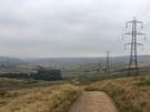
Unfortunately the magic didn't last, the glorious start to the day replaced by dank greyness by the time I'd crossed the M62, and soon I was walking across moorland adjacent to marching electricity pylons, their wires fizzling in the misty air.
For the first time on the Pennine Bridleway today's leg didn't follow a dismantled railway line at all. But on the final stretch of moorland, another familiar wayfinding mechanism returned: across Langfield Common the line of the path is marked by big flagstones sunk into the ground, a memory of many walks on the Pennine Way. Eventually the mist cleared sufficiently to reveal another old friend — Stoodley Pike Monument — just a shade beyond my destination for the day.
It's been good to get out these four days. I'll be back soon for the next hundred miles or so.
Sunday, 15 July 2018
Pennine Bridleway
Birch Vale → Diggle
 Distance: 21.23 miles
Ascent: 956 metres
Duration: 7 hours 4 minutes
Fire
« Not walked | Not walked »
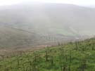
My original intent had been to walk these four sections of the Pennine Bridleway a fortnight ago, but I put that plan on hold when a week earlier news broke of a wild fire raging on Saddleworth Moor. Today's leg traced the edge of the fire ground.
 Before getting there, I took the "non-bridleway" section of the bridleway. Being a new National Trail, the route isn't yet fully established, and for a section between Cown Edge and Lees Hill there isn't yet a path with bridleway access. Horses and cyclists take to the roads while I followed the "interim" walkers' route. This alternative route followed the sharp line of Coombes Edge, curving high above Charlesworth for a delightful mile or so, but the section wasn't well signposted at all, so I was glad to have checked the line of the path on the National Trails website before setting out. (On the positive side, the route took me past a couple of tremendously-dressed wells just before leaving Derbyshire.)
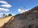 Higher Swineshaw Reservoir provided an excellent point from which to view the fire damaged moors. Framed by the water and the deep blue sky, the blackened land took on an unusually beautiful hue, but after walking a few miles along the Moor Edge Road, with burned heather to the right and luscious pasture to the left the extent of the destruction was clear. Despite that, it was pleasing to see tiny flecks of green amongst the charred earth. It could have been source material for a parable about never being too late to start again.
 Eventually leaving the moor, the path dropped to follow yet another disused railway line (they seem to be a feature of the Bridleway) along the Tame valley to the village of Diggle, the southern end of the Standedge canal and railway tunnels under the main Pennine ridge, whose ventilation shafts we saw last year on from the Pennine Way walk.
Notes for future walkers:
- The walkers' alternative is poorly signposted. Check the route before you set out.
- I lost sight of the path on both sides of the A626 Glossop Road north of Charlesworth. Approaching the road from the east I couldn't find the path heading north from SK 010 936, and after crossing the road I ended up on the wrong side of the fence at SK 007 938. This latter mistake seems to be down to a poorly-signed recent re-routing of the path.
- The route at SK 001 947 (The Hague) looks impassable due to an imposing iron gate. There's a similarly huge kissing gate hiding to the left.
- The worst-maintained footbridge I've ever seen is at SK 007 976 in Swallow's Wood Nature Reserve. Thankfully the water level was low and I was able to find an alternative route round the precarious structure.
Saturday, 14 July 2018
Pennine Bridleway
Blackwell → Birch Vale
 Distance: 19.20 miles
Ascent: 683 metres
Duration: 6 hours 41 minutes
Water
« Not walked | Not walked »
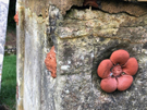
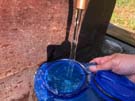 Since the theme of yesterday's walk was earth, today's had to be water. It was set before I'd even taken the bus back out to Blackwell. Staying in Buxton overnight there was only one way I could've filled up my water carrier: direct from the source at St Anne's Well. Like all other wells in the town, it had been dressed for the local festival, a practice I'd not come across before. Apparently a Derbyshire tradition, great frames of wet clay are affixed to the well heads, into which petals, leaves, feathers and all manner of other materials are pressed to create a scene. Had I known more, I would have sought out these wells over the past two walks.
 As for today's walk, after a charming start deep in Chee Dale beside the River Wye, most of the first half was a little tedious, plodding along quiet tarmac lanes. On reaching the High Peak though, the trail transformed and became an absolute joy. Ahead I could see Kinder Low, evoking memories of the climb out of Edale last year on our first day walking the Pennine Way. The number of cyclists on the path picked up; some whizzed by, while others stopped suddenly to see what I was photographing (and then seemed surprised to realise that the views were stunning).
 I was hoping to see a monument in Hayfield commemorating the mass trespass of 1932, considered by many to be the start of the movement to secure public access to our country's land, but if there was one I couldn't find it.
The final stretch of the day from Hayfield to Birch Vale was a little less inspiring, along the line of another disused railway, but was at least very easy walking.
Notes for future walkers:
- Amongst the buildings at Mosley Farm (SK 115 730), the Bridleway turns north away from the drive, but this is easy to miss. If you miss the turn, continue along the drive — the Bridleway soon rejoins it.
Friday, 13 July 2018
Pennine Bridleway
Middleton Top → Blackwell
 Distance: 19.02 miles
Ascent: 164 metres
Duration: 4 hours 55 minutes
Earth
« Not walked | Not walked »
 Yes, I know we've already finished the Pennine Way. This is something different. The Pennine Bridleway is the newest of the fourteen National Trails of England and Wales, and aims to provide a route through the Pennines that can be used not just by walkers, but by horse riders and cyclists too. The route currently stretches 200 miles from Derbyshire to Cumbria, but there are outline plans to eventually extend it to Byrness in Northumbria.
So I'm walking again, hoping to complete the trail over a few weekends this summer.
 Frankly, today's walk hasn't been particularly inspiring. Almost the entire length followed the line of a dismantled railway that was originally used to transport stone from nearby quarries. Stone is everywhere here. In the high fields, clusters of exposed rock reveal the geology that lies just below the surface: fuel for the limestone quarries and brickworks not far from the trail. Had I known about it, I'd have allowed time to explore the National Stone Centre close to the start of the walk. Perhaps another time.
 Another sight I missed was Arbor Low — a neolithic henge about halfway along the route. (Think Stonehenge but with all the uprights toppled. I had no idea such a place existed, which perhaps says more about my ignorance of the centre of our island than anything else.)
The route strikes away from the line of the old railway just ahead of an active quarrying site and heads north across the folds of the landscape towards the main road into Buxton. Hopefully tomorrow's leg will be more varied than today's.
Notes for future walkers:
- To reach the start of the walk at Middleton Top, follow the road from Cromford Station to the crossroad in the village, then continue on the pavement straight ahead uphill (A5012, then B5036). Ignoring the B5035 turning for Middleton Top, continue ahead and take a path on the right just before a railway bridge takes you up to the old line. Crossing over the Steeple Grange Light Railway then pick up the High Peak Trail which runs steeply uphill past the National Stone Centre to Middleton Top.
Sunday, 24 June 2018
Solas
Solas 2018: Drift
 A field in the sun; familiar faces; an eclectic and mind-stretching programming: the ninth Solas Festival.
This year's theme of Drift took in the stories of cultures in migration, and some of the more subtle drifts in language, history and politics, soundtracked by new and emerging bands from around Scotland.
 The programme was book-ended by Arabic voices. Shamstep group 47SOUL had everyone out-dancing the midgies on Friday night, and a "learn Palestinian Arabic through the medium of za'atar" session turned out to be a thoughtful introduction to a unique new online learning course, developed by the universities of Gaza and Glasgow, which enables Gaza-based tutors to teach despite the restrictions imposed by the occupation.
Other highlights included:
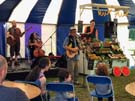 The Barrow Band's singing and dancing fruit and veg
Professor John Curtis's talk on the Scottish Independence and EU referendums. I came away with the uneasy sense that Scotland might not lean as far to the left as its political representation suggests, leading to the chilling question of what would happen should Scotland gain independence. Would there be any need for the SNP? ("Look at UKIP.") Would a rebranded Conservative party become a dominant political force?
Vox Liminis' Distant Voices project bringing songs written by those with first-hand experience of the criminal justice system to a wider audience
 In between, there was the typical mix of the wondrous and sometimes bizarre that we've come to love at Solas. Where else can you turn a corner from the world-class Scottish Opera performers, and run straight into a towering-costumed street performer wielding a chuckling, demonic-looking baby; or enjoy a film about house music in Africa in the company of Molly, the site's horse, whose stable was being used as a cinema?
Thursday, 21 June 2018
Saturday, 16 June 2018
Gig
Massive Attack / Young Fathers
 "What a time to be alive!" were the spoken opening words of Young Fathers's support slot. What followed was a sonic and visual assault that stayed with me long after the gig, and wiped any memory of the first support act. We were at the Eden Sessions to see Massive Attack, and while the Bristol group's headline set was even better than I'd hoped (I've been meaning to see them live for years), it was the intimidating support that really got beneath my skin. The sound was loud, and the dancing and posturing from the stage as effective as any haka.
Massive Attack's own set was fantastic. Towards the end, "We are all in this together" flashed up on the screen at the back of the stage, jarringly demonstrating neatly how words that seem so hollow from one person can appear authentic and urgent from another.

Friday, 25 May 2018
St Cuthbert's Way
Kirk Yetholm → Wooler
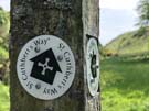 Distance: 13.53 miles
Ascent: 707 metres
Duration: 4 hours 50 minutes
Scotland to England
« Not walked | Not walked »
The first thing the B&B owner asked us last night was, "Do you know how you're leaving Kirk Yetholm?"
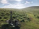 This village may be the northern end of one of Britain's best known trails but it doesn't have particularly good transport links. What it does have though is another long distance path.
So today, a day after finishing the only National Trail that crosses into Scotland, we're embarking on the only one of Scotland's Great Trails that enters England — St Cuthbert's Way.
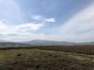 The section from Kirk Yetholm to Wooler is right in the middle of St Cuthbert's Way, which runs from Melrose to Lindisfarne. It follows the Pennine Way south for a couple of miles before heading east at the border.
The rest of the walk was across moorland and along gentle valleys in the shadow of the Cheviot: a perfect way to wind down after a week of heavy walking.
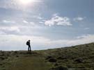
We head home tomorrow, but we'll be back to cross the border again soon. After all, we may have nearly completed the National Trails of England and Wales, but Scotland has twenty-nine Great Trails for us to explore.