Monday, 15 September 2014
Places
Weaving a Union
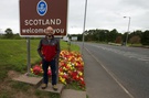
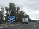
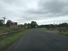
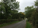
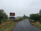
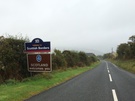
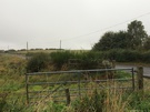
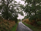
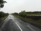
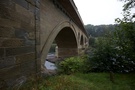
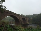
Today I drove from the west coast to the east. And as journeyed I zig-zagged back and forth across the Scottish border, placing a stitch in England and another in Scotland at each of the twenty-four places a public road crosses the border.
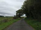
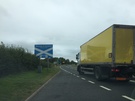
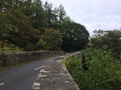
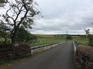
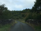
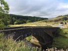
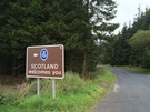
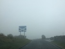
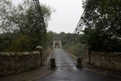
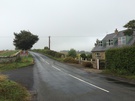
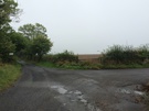
Here are the two dozen roads. Each photograph was taken in England looking towards Scotland.

Two thing were evident from today's trip.
First, the border is a stunningly beautiful place, even in today's drizzle. From Gretna where "No" campaigners have been constructing a "Hands across the Union" cairn to Lamberton where the A1 thunders across the invisible dividing line, this is a landscape I scarcely know.
My second observation is that after a few crossings I began to forget which side I was on. On occasions the English side of the border felt Scottish with tall pine forests while the gently sweeping pasture to the north felt English. The border line became invisible in places; at a few of the crossings it wasn't marked at all.
On Friday we'll discover whether or not this will become a new frontier. Either way, I'm inclined to start planning a walk that mirrors today's drive.
Side note:
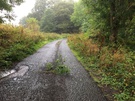
The most unusual part of the journey was the twelve-mile unsurfaced Kielder Forest Drive. A lot of fun although a little nerve-racking in a Honda Jazz, particularly when I got to what appeared to be a roadblock manned by Gherkas on exercise.